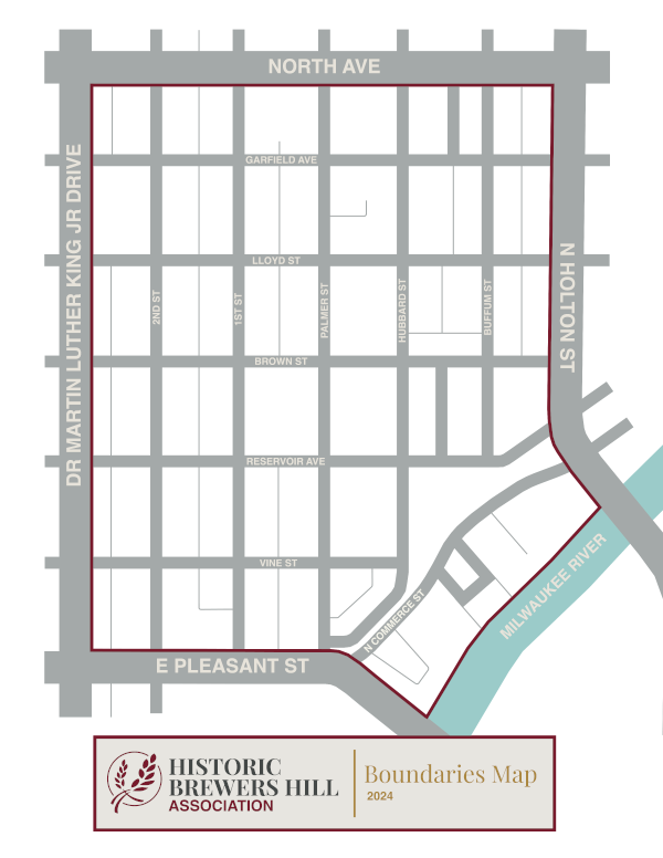
Brewers Hill Neighborhood
Boundary Map
The Historic Brewers Hill Association (HBHA) boundaries align with the Brewers Hill neighborhood boundaries as designated by the city of Milwaukee: the south side of North Avenue (northern border), the north side of Pleasant Street (southern border), the east side of Dr. Martin Luther King Jr. Drive (western border), and the west side of Holton Street (eastern border). Our southeastern border ends along the riverfront.
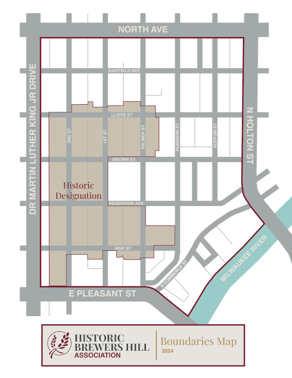
Brewers Hill Historic District
Local Designation Map
Portions of the Brewers Hill neighborhood are designated as a Local Historic District. For geographical boundaries of the Brewers Hill Historic District, refer to the Local Designation Map below. For additional information, visit our Historic Preservation page.